Let’s be honest, the weather forecast hasn’t been giving us much to smile about lately, has it? If you’ve been looking up at the sky over the last few months, hoping for a decent downpour, you certainly aren’t alone. After what was officially recorded as the nation’s driest April in eight long years, our lawns were looking crispy, the dust was settling in, and a lot of us were feeling pretty pessimistic about the winter ahead.
Add the looming, ominous shadow of an El Niño climate pattern in the near future, and expectations for any kind of drought relief this May were sitting somewhere between “slim” and “absolutely none.” We were all bracing for a dry, dusty, and challenging season.
But Mother Nature loves a good plot twist! In a highly welcome surprise of weather variability, the very first north-west cloudband of 2026 is finally developing over Australia this week. And it’s not just a tiny sprinkle, either. We are talking about a massive, sweeping system delivering a broad band of beautiful, life-giving rain from the warm tropics right down to the chilly tips of Tasmania.
Grab a warm cup of tea, get cozy, and let’s dive into exactly what this massive weather system is, why it’s been missing in action, and what it means for our thirsty country.
The Dry Spell That Had Us Worried
To understand why this current rain event is such a monumental deal, we have to look back at the start of the year. Sure, February and March brought some intense tropical lows that dumped abundant rain over parts of Australia’s interior. If you were up north, you might have even seen some flooding. But that moisture was incredibly localized and didn’t spread evenly across the country.
Then came April.
April 2026 will go down in the record books, and not for a good reason. It was the driest April we’ve experienced in eight years. Farmers were looking at their paddocks with deep concern, water tanks in rural areas were dipping dangerously low, and the dreaded “D” word—Drought—was starting to make its way into the daily news cycle again.
When the Bureau of Meteorology started talking about an “unfavourable monthly outlook” and the strong possibility of an El Niño (a climate pattern typically associated with hotter, drier conditions in Australia), the collective sigh across the nation was almost audible. We needed a hero, and we needed it fast.
Enter the Hero: What Exactly is a North-West Cloudband?
You might be hearing meteorologists on the evening news throwing around the term “north-west cloudband” (or NWCB for short) and wondering what makes it so special. Why is it different from a regular rainy Tuesday?
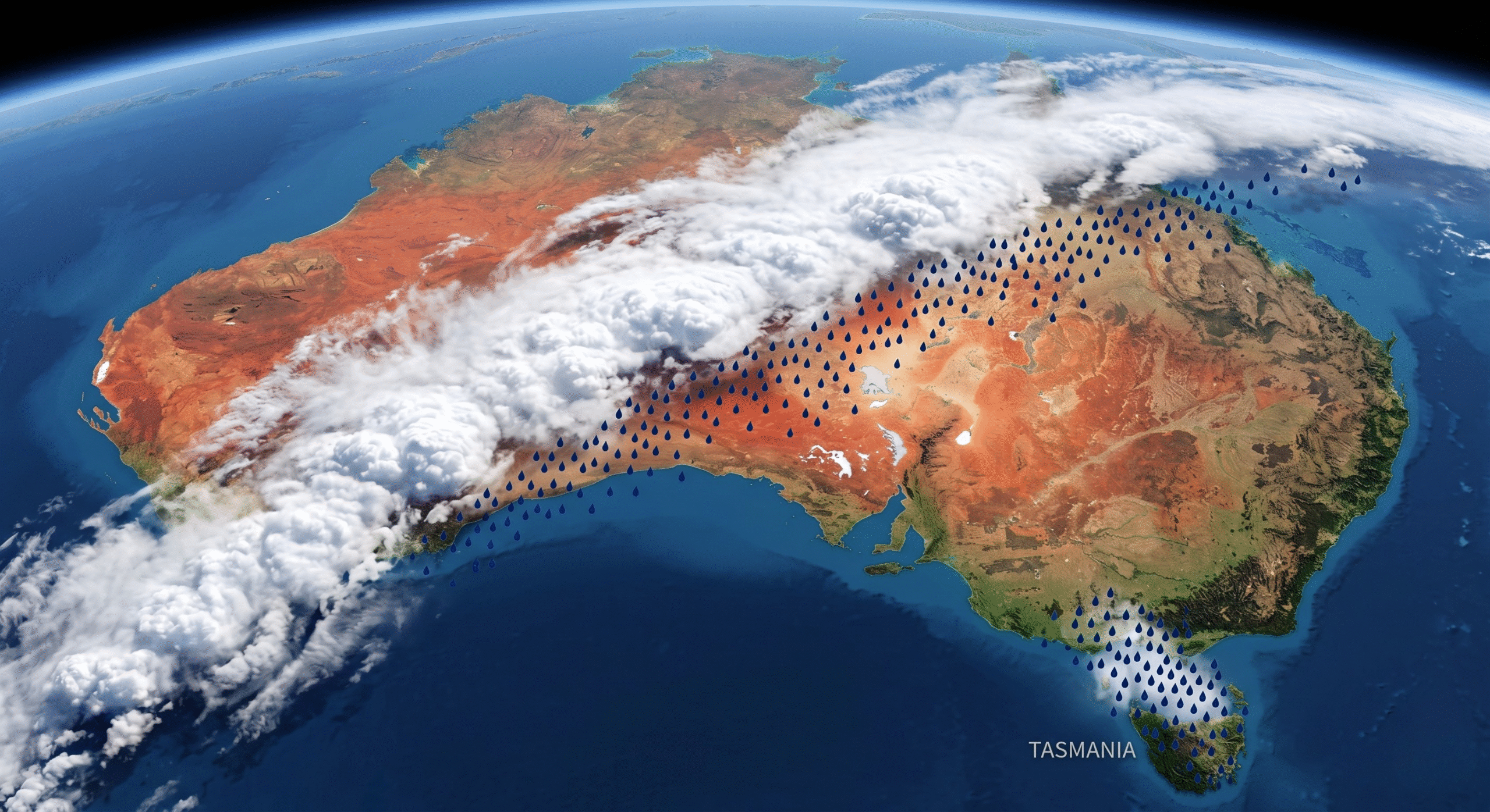
Think of a north-west cloudband as a gigantic, floating river in the sky. These systems are the absolute titans of the Australian weather map. If you look at a satellite image, an NWCB is the most extensive, dramatic cloud feature you will ever see. It literally looks like a thick, white sash draped diagonally right across the continent.
They start way up in the warm, tropical Indian Ocean off the northwest coast of Western Australia. They suck up massive amounts of tropical moisture, bundle it all together into heavy clouds, and then ride the high-altitude winds southeast. They stretch for thousands and thousands of kilometres, traveling across the desert interior, sweeping over South Australia, New South Wales, and Victoria, before finally blowing out over Tasmania and the Tasman Sea.
Why We Desperately Needed This System
Here is a fun, slightly nerdy weather fact for you: these elusive rainbands are the undisputed champions of outback rainfall. In fact, north-west cloudbands are responsible for up to 90 per cent of the cool-season rain across Australia’s vast inland.
Let that sink in. Without these specific cloudbands, the interior of our continent practically gets no winter rain at all.
This is exactly why the first few months of 2026 felt so terrifyingly dry for so many regions. There was a notable, glaring absence of these NWCBs. We had those tropical lows in late summer, but once autumn rolled around, the atmospheric setup just wasn’t right to funnel that moisture across the desert. The giant sky-river had run dry. Until now.
The Journey of the Clouds: Who is Getting the Rain?
So, how is this week going to play out? The beauty of a north-west cloudband is its sheer scale. It’s not just a lucky shower for one city; it’s a cross-country tour of precipitation.
- The Tropics and Western Australia: It all kicks off here. The warm waters off the Pilbara and Kimberley coasts are brewing up a thick soup of moisture. While the coastal areas might just see heavy, humid clouds, as the system moves inland over the Pilbara, the rain starts to fall.
- The Red Centre: As the band stretches southeast, it passes right over the heart of Australia. Places like Alice Springs and the surrounding dusty outback, which have been parched for months, are finally seeing dark skies and feeling the cool relief of steady rain soaking into the red dirt.
- South Australia & New South Wales: The cloudband acts like a conveyor belt, dragging that tropical moisture right over the agricultural heartlands. Farmers in SA and western NSW, who were biting their nails over their winter crops, are getting a crucial, season-saving soaking.
- Victoria & Tasmania: By the time the system reaches the southeast, it often links up with cold fronts rushing up from the Southern Ocean. This is where the weather gets wonderfully dramatic. The tropical moisture collides with the freezing southern air, resulting in widespread, steady rainfall across Victoria and right down into Tasmania.
Looming El Niño: The Elephant in the Room
While we are absolutely celebrating this glorious, soaking rain, we still have to be realists. Does this one north-west cloudband mean we are entirely out of the woods? Unfortunately, no.
The climate models are still pointing towards El Niño lurking in the near distant future. El Niño typically shifts the warmest ocean waters away from Australia and over towards South America. When that happens, the fuel source for our beautiful north-west cloudbands gets cut off. That’s why El Niño years are notoriously dry for us.
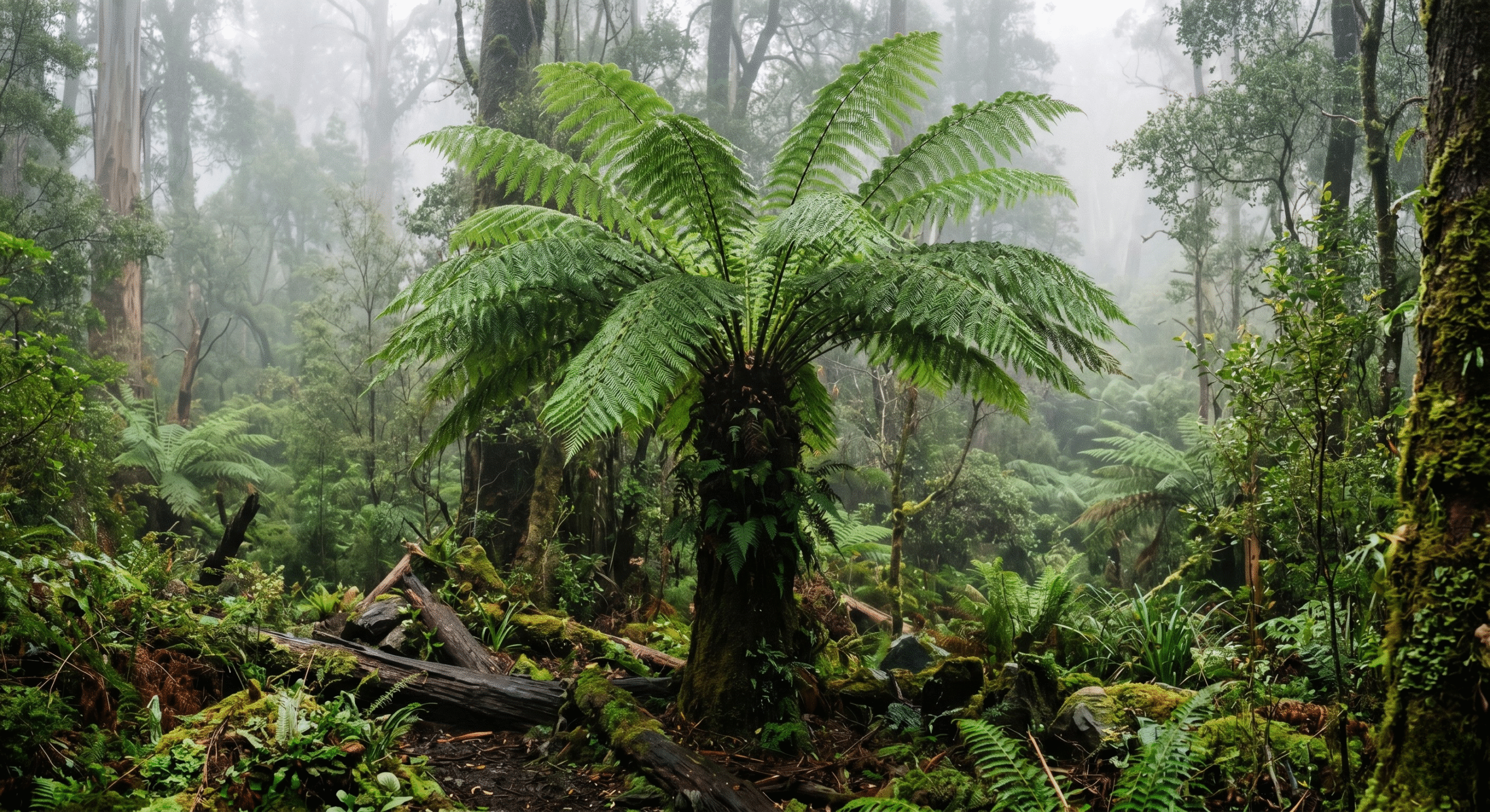
However, weather is not climate, and variability is the name of the game. Even in dry years, individual weather systems like this one can and do form. This current downpour is essentially buying us time. It is filling up the dams, putting moisture back into the topsoil so seeds can germinate, and giving the natural environment a much-needed drink to sustain itself through whatever dry patches might be coming next.
The Difference Between Tropical Lows and Cloudbands
It’s easy to get confused when the news talks about “tropical moisture” saving the day. After all, didn’t we just have tropical lows a few months ago?
Yes, we did! But they behave very differently. A tropical low is like a spinning top. It drops a massive, concentrated amount of rain in one specific area, often causing flash flooding, before spinning itself out.
A north-west cloudband, on the other hand, is like a slow-moving, gentle garden hose that you drag across the entire yard. Because it stretches across the continent and moves steadily, it delivers widespread, soaking rain over a massive area. It’s the kind of rain that actually penetrates the dry soil rather than just washing away the top layer. It is the perfect, gentle, widespread drink that the Australian landscape evolved to rely on.
What This Means for You
If you live in the path of this week’s cloudband, it’s time to prepare.
- For the everyday Aussie: It’s time to find where you hid your umbrellas and raincoats back in 2025! Expect a few grey, cozy days. It’s the perfect excuse to stay indoors, bake something, and listen to the rain on the roof.
- For the gardeners: Turn off your sprinkler systems! Let nature do the heavy lifting this week. This deep soaking will do wonders for your winter veggie patches.
- For the farmers: It’s a moment of cautious relief. This rain is the perfect primer for winter planting.